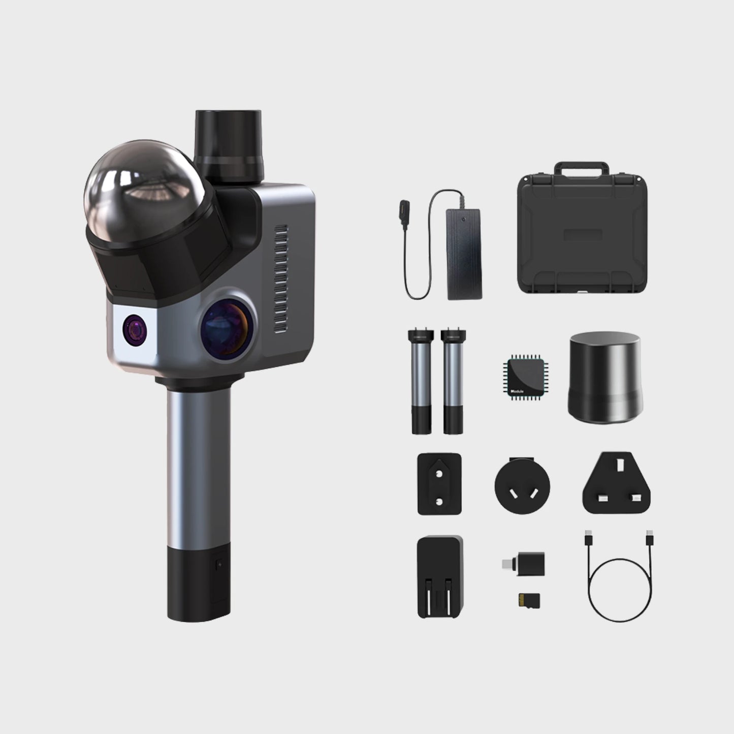
Redefining LiDAR Scanning Precision and 3D Spatial Data Acquisition
3D Scanner & Software Bundles
Why Choose the HAWK LiDAR Scanner?
Technical Specifications - HAWK LiDAR Scanner
| Accuracy | 1.5cm@10m; 3cm@20m; 5cm@40m |
| Scan Radius | 40–70m (measured at >10% or >80% reflectivity) |
| Scan Range | 80–140m |
| Scan Angle | Horizontal 360°, Vertical 63.5° |
| Point Cloud Frequency | 484,000 points/second |
| Laser Light Source | 905nm |
| Eye Safety | Class 1 (IEC60825-1:2014) Eye safe |
| HDR Mode | Supports 3–5 EV |
| Color Texture | 2x 13MP 1-inch sensor camera Single camera NIR visual tracking system |
| Data interface | 2x USB-TypeC |
| Network support | Wi-Fi 5 |
| Screen | 3.9" AMOLED |
| Output format | 3D Color Point Cloud PLY 3D Gaussian Splatting PLY 3D Colored Polygonal Model OBJ |
| Built-in battery | 12000 mAh, supports 1 hour of work, supports external power supply while charging |
| Volume | 120 × 145 × 85 mm |
| Weight | 900 g |
| Configuration | 8 Cores 2.4GHz 32GB (Supports TF card expansion) |
| Recommended Configuration | Processor: Intel Core i7 Memory: 64GB RAM Graphics Card: NVIDIA RTX 4060, 16GB VRAM |
| Minimum Configuration | Processor: Intel Core i7 Memory: 32GB RAM Graphics Card: NVIDIA RTX 3060, 12GB VRAM Note: Gaussian Splatting is only supported on NVIDIA GPUs. |
Industry Applications
Frequently Asked Questions
Looking for something specific? Let us know, and we’ll be happy to assist you.
It achieves 1.5 cm precision at 10 m and captures 480 000 points per second, ensuring high-precision LiDAR point cloud data acquisition for mapping, surveying, and inspection.
The positioning system integrates high-precision GNSS and IMU inertial navigation, providing real-time positioning, yaw tracking, and attitude information for differential orientation and stable scanning.
Yes. Its dual 13 MP cameras and NIR tracking module capture color point clouds with rich image information, producing accurate 3D spatial reconstructions.
HAWK is widely used in surveying, mapping, forestry, land planning, digital city construction, mine safety, and geological disaster monitoring, as well as for inspection tasks and terrain analysis.
Yes. The lightweight LiDAR scanner can be mounted on multi-rotors, vehicles, or tripods, using high-precision GNSS and INS positioning systems for stable, real-time 3D scanning in large-area mapping and hard-to-reach locations.


