


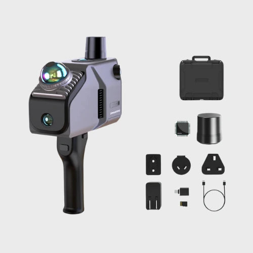


| Feature | Eagle Standard | Eagle Max |
|---|---|---|
| Camera System | 1x 48MP 8K HD camera | 4x 48MP 8K HD |
| Accuracy | 2cm@10m, 5cm@40m | 2cm@10m, 5cm@40m |
| Scan Range | 80-140 meters | 80-140 meters |
| Output Quality | High-resolution color mapping | Premium 3D Gaussian Splatting |
3D Scanner & Software Bundles
Main product

Eagle LiDAR Scanner
Add-on products

Quicksurface Reverse Engineering Software

Geomagic Design X Reverse Engineering

Geomagic Control X Inspection
Your bundle
See How Businesses Use This in the Real World
-

Immersive Panoramic Tours
Publish a single capture as an interactive panoramic tour, letting clients navigate a space remotely with the same layout and detail as a walkthrough in person.
-

Photorealistic City Asset
Turn a walkthrough into a photorealistic 3D city asset, capturing textures, materials, and layout with enough detail to support planning, visualization, and archival use.
-

Large Scale Structures
Capture entire building complexes in a single pass, producing dense, detailed point clouds across large sites with several connected structures.
-

Real Estate Surveying and Mapping
Generate accurate 3D data of residential properties to support listings, walkthroughs, and site documentation for real estate teams.


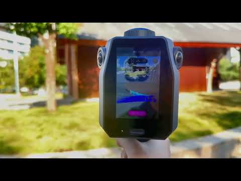
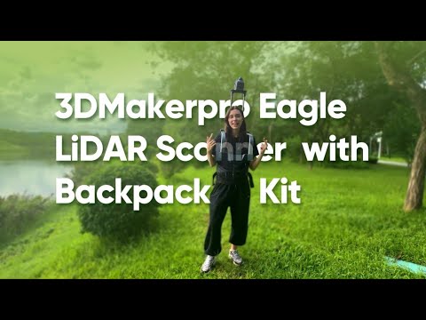
Eagle LiDAR Video Review & Tutorials
Compare 3D Scanners
Select up to 4 scanners to compare key specifications side-by-side.
| Product Name |

|
||||
|---|---|---|---|---|---|
| Eagle LiDAR | |||||
| Object Size for Best Results | Eagle (40 - 70 m) | Eagle Max (80 - 140 m) | ||||
| Accuracy up to | 2cm @ 10 meters | 3cm @ 20 meters | 5cm @ 40 meters | ||||
| Resolution up to | - | ||||
| Volumetric accuracy up to | 2cm @ 10m | 3cm @ 20m | 5cm @ 40m | ||||
| Max FOV | Horizontal 360°, Vertical 59° | ||||
| Scan speed up to | 200,000 points/s | ||||
| Light source | 905 nm Laser | ||||
| Number of laser lines | - | ||||
| Color scanning | Yes | ||||
| Wireless | Yes | ||||
| Marker free | Yes |
Ecosystem, Add-ons & Integrations
Request a QuoteThe Eagle LiDAR supports an extensive range of auxiliary add-ons and software to expand your capabilities.
-

RayStudio Software
Software designed specifically for the Raven that automatically analyzes 3D data, performing essential tasks like point cloud denoising and filtering.
-

RTK Expansion Kit
Enhance your high precision mapping, global positioning, and real scene comparison.
-

Specialized Mounts
Easily mount your scanner onto backpack, bicycles, and cars, for specialized projects.


What's Included in Your Purchase?
-

Eagle
- Eagle LiDAR Scanner
- Handle
- PD Power Adapter
- 1.5m Dual Ended Type C Cable
- TF Card 125 GB
- USB - C to USB - A Adaptor
- Optional: RTK Module
-

Eagle Max
- Eagle Max LiDAR Scanner
- Handle
- PD Power Adapter
- 1.5m Dual Ended Type C Cable
- TF Card 125 GB
- USB - C to USB - A Adaptor
- Optional: RTK Module


Eagle LiDAR System Requirements
| Component | Requirement |
|---|---|
| OS Requirements | Windows 11+ (Incompatible with macOS) |
| Recommended Configuration |
Processor: Intel Core i7 Memory: 64GB RAM Graphics Card: NVIDIA RTX 4060, 16GB VRAM Note: Gaussian Splatting is only supported on NVIDIA GPUs. |
| Minimum Configuration |
Processor: Intel Core i7 Memory: 32GB RAM Graphics Card: NVIDIA RTX 3060, 12GB VRAM Note: Gaussian Splatting is only supported on NVIDIA GPUs. |
Quicks Start Resources


Frequently Asked Questions
Looking for something specific? Let us know, and we’ll be happy to assist you.
This is crucial as it covers the numbers people look for first.
- Scanning Radius: Up to 70 meters (at 80% reflectivity).
- Accuracy: Up to 2 CM at a 10-meter distance.
- Coverage Angle: 360° x 59° field of view.
- Capture Speed: Collects up to 200,000 points per second.
The Eagle supports Colorful Scanning via its high-resolution cameras (Max version has four 48 MP cameras; Standard has one 48 MP camera). It outputs vivid, detailed 8K HDR imaging and can create Immersive Panoramic Tours.
3D Gaussian Splatting is a technique that transforms captured photos into Gaussian distributions to generate highly realistic 3D scenes. The content is compatible with industry tools like Unreal Engine, enabling rapid construction of premium 3D environments.
Yes, it is an All-in-one Scanning Solution that is Ready to Use with no complex calibration required, saving up to 50% of preparation time. It features a built-in 3.5-inch screen for On-Site Review Operations, offering real-time point cloud and photo display.
Yes, it is highly adaptable and can be used on various platforms and vehicles. It maintains high data quality even when operating dynamically at speeds of up to 20 km/h.